
Overview
Difficulty
2
Time To Complete
0.25 hours
Distance
0.1 miles
Seasonality
Spring, Summer, Fall, and Winter
Land Website
Floyds Fork
Topo Map
Floyds Fork Map
Dog Friendly
Yes
Destination Highlights
Most Of A Day
Intro
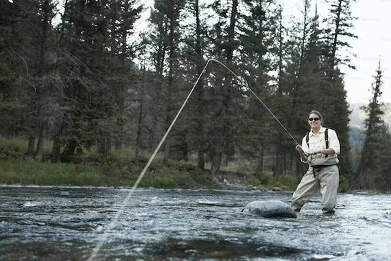
Whether you’re seeking bass on the fly, a large smallmouth on a lure, or looking to catch your first rainbow trout, Floyds Fork provides anglers with options. The river is divided into three daily distinct sections. Choose to float from North Beckley Creek to Creekside (2.0 miles), Creekside to Fisherville (4.5 miles) or Fisherville to Cane Run (4.5 miles). You’ll run into small rapids, long, deep, pools with structure bass adore, and shallow bars that are home to classic riffle sections.
The river is suitable for wade-fishing, though note public access is only allowed at each of the ramps. It’s popular for anglers fishing from rafts, kayaks, canoes, and even stand-up paddleboards. On the last float section of the river, you have the chance of fishing for channel catfish and if you hook into one of those on a SUP, be prepared for a wild ride!
What Makes It Great
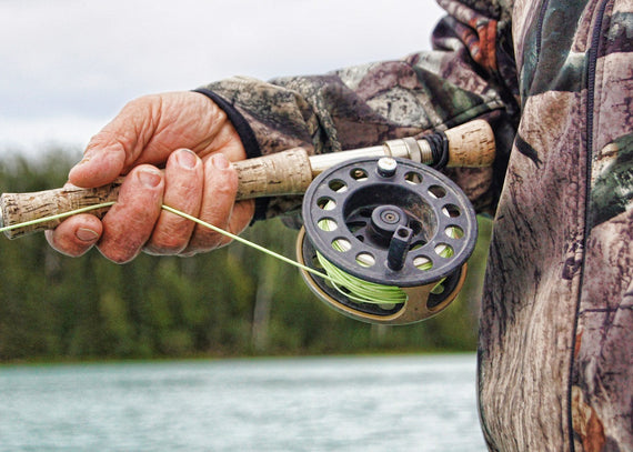
The river’s three sections offer a unique variety of experiences and fishing conditions. Fly anglers should come prepared with a variety of small streamers, poppers, and terrestrial dry flies. Traditional spin-fishermen should pack chugger-style topwater baits, tube baits, and even soft plastic jerkbaits rigged weightless (pearl and albino shad are local favorites).
The first two-mile float begins at North Beckley Creek (off U.S. 60 in Eastwood) and finishes at Creekside. Ideal for a quick drift after work, this stretch is small and intimate, with good numbers of smallmouth, rock and spotted bass. A few largemouth can be found as well, though most productive evenings are spent plying the boulder-strewn river for smallmouth.
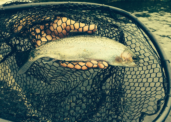
Rainbow trout are stocked at the first of the new “leaping deer” bridges in this section, as well as at the North Beckley Access Point. A total of 3,600 rainbows are stocked by the Kentucky Department of Fish and Wildlife in October, March, and April. Seasonal catch and release regulations are enforced from October 1 through March 31. All trout caught must be immediately released and only artificial baits may be used during the catch-and-release period. If you intend to pursue trout, a trout permit is required.
The second float section covers 4.5 miles, from Creekside to Fisherville Paddling Access. Be sure to fish the root wads and woody cover along the banks in the early part of the section—a jerky presentation of a pearlescent or light pattern is almost irresistible to bass here. Midway through the float you’ll start to notice deep holes. Fishing the beginning and end of these holes is productive. Also target undercut banks and above / below riffle sections.
The third and final section begins at Fisherville paddling access and ends 4.5 miles downstream at Cane Run Paddling Access. Prospect deep holes and fallen trees for largemouth and spotted bass and look for smallmouth in quicker water just above and below stream drops. Channel catfish can also be found in this section and offer a unique challenge for anglers.
Who is Going to Love It
The considerable development at the Parklands of Floyds Fork mean plenty of infrastructure and resources for the area. Families can appreciate the playgrounds and picnic areas at the Parklands before embarking on a comfortable float on the river. A variety of species in three varied floats means anglers won’t be bored and the opportunity to fish for stocked rainbow trout draws both serious fishermen and young children alike. This is the perfect place for a youngster to catch their first trout.
Directions, Parking, & Regulations
From downtown Louisville, get on 1-64 E, continue to Middletown. Take exit 27 from 1-265 / KY-841 E / Gene Snyder Freeway. Continue on U.S.-60 E / Shelbyville Road. Turn left on S Beckley Station Road, which will lead you directly to the Parklands.
Be aware that from U.S. 60 downstream to U.S. 150, there is a one-fish daily creel limit and 15-inch minimum size limit for largemouth and smallmouth bass taken on the stream.
Ramp to ramp distances: North Beckley Creek to Creekside: 2.0 miles Creekside to Fisherville: 4.5 miles Fisherville to Cane Run: 4.5 miles
Written by Jess McGlothlin for RootsRated in partnership with Kentucky Tourism and legally licensed through the Matcha publisher network. Please direct all licensing questions to legal@getmatcha.com.
 loading="lazy"
 loading="lazy"
 loading="lazy"